Solar Panel Tilt Calculator

Best year-round and seasonal tilt angles from your latitude, plus the shade-free row spacing for ground-mount and flat-roof arrays.

Site and Panel

Negative for the southern hemisphere

Enter your racking angle to size the row spacing for it

Total sloped length if panels are stacked two-high

Tip

Find your latitude by dropping a pin in any maps app. Spacing assumes level ground and rows running east to west; on a slope facing the equator you can space rows closer, on a slope facing away they need more room.

Results

Best fixed year-round tilt

-

Winter solstice tilt

-

Summer solstice tilt

-

Spring / autumn tilt

-

Ground coverage ratio

-

Panel top height above its base

-

Design sun position (winter solstice)

-

Clear gap between rows

-

Row pitch (front to front)

-

Row Spacing (to scale)

The trigonometry of panel tilt

A solar panel produces the most when sunlight strikes it at a right angle. The sun's height in the sky at solar noon is set by two numbers: your latitude and the sun's declination, which swings between −23.44° and +23.44° over the year because the Earth's axis is tilted by that amount.

noon sun elevation = 90° − latitude + declination

tilt that faces the noon sun = latitude − declination

winter solstice tilt = latitude + 23.44°

summer solstice tilt = latitude − 23.44°

Those seasonal angles are exact geometry. The single best angle for a panel that never moves is not: it depends on how much of your annual sunshine arrives in each season. The calculator uses a widely quoted fit, 0.76 × latitude + 3.1° between 25° and 50° latitude (0.87 × latitude below 25°), which lands a few degrees flatter than latitude because long summer days outweigh short winter ones. Treat it as a starting point and confirm the yield with a simulation tool such as NREL's PVWatts before you order racking.

Tilt angles by latitude

LatitudeYear-round (approx.)Winter solsticeEquinoxSummer solsticeNoon sun elevation, winter solstice
0.0°23.4°0.0°0.0°66.6°
10°8.7°33.4°10.0°0.0°56.6°
20°17.4°43.4°20.0°0.0°46.6°
25°21.8°48.4°25.0°1.6°41.6°
30°25.9°53.4°30.0°6.6°36.6°
35°29.7°58.4°35.0°11.6°31.6°
40°33.5°63.4°40.0°16.6°26.6°
45°37.3°68.4°45.0°21.6°21.6°
50°41.1°73.4°50.0°26.6°16.6°
55°44.9°78.4°55.0°31.6°11.6°
60°48.7°83.4°60.0°36.6°6.6°

Row spacing: how long is the winter shadow?

A tilted panel is the hypotenuse of a right triangle. Its top edge sits panel length × sin(tilt) above its base, and that height casts a shadow of height ÷ tan(sun elevation). Before and after noon the sun is off to one side, so only part of that shadow points toward the next row; multiplying by cos(azimuth) gives the part that matters.

height = panel length × sin(tilt)

sin(elevation) = sin(lat)·sin(dec) + cos(lat)·cos(dec)·cos(hour angle)

sin(azimuth) = cos(dec)·sin(hour angle) ÷ cos(elevation)

gap = height ÷ tan(elevation) × cos(azimuth)

row pitch = panel length × cos(tilt) + gap

The hour angle is 15° per hour from solar noon, so 9 am and 3 pm are both 45°.

Worked example: 35° latitude, 78 in panel, 9 am to 3 pm

  1. Year-round tilt = 0.76 × 35 + 3.1 = 29.7°.
  2. Panel height = 78 × sin(29.7°) = 38.6 in.
  3. Winter solstice, hour angle 45°: sin(elevation) = sin 35° × sin(−23.44°) + cos 35° × cos 23.44° × cos 45° = −0.2282 + 0.5315 = 0.3033, so elevation = 17.7°.
  4. sin(azimuth) = cos 23.44° × sin 45° ÷ cos 17.7° = 0.681, so the sun is 42.9° off due south.
  5. Gap = 38.6 ÷ tan(17.7°) × cos(42.9°) = 121.4 × 0.732 = 88.9 in (about 7' 5").
  6. Row pitch = 78 × cos(29.7°) + 88.9 = 67.8 + 88.9 = 156.7 in, a ground coverage ratio of 78 ÷ 156.7 = 50%.

Designing for noon only would need just 38.6 ÷ tan(31.56°) = 62.9 in of gap, but the rows would shade each other for most of a December morning and afternoon.

Practical notes

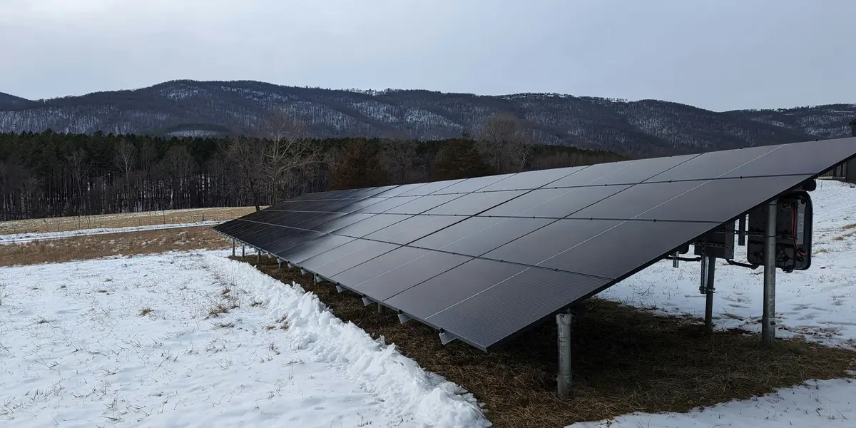
  • Steeper tilts shed snow and dust better but need more row spacing and catch more wind. Racking and foundations must be engineered for local wind and snow loads.
  • On a pitched roof, mounting flush to the roof is almost always the right call; the few percent gained from re-tilting rarely pays for the racking and wind load.
  • Square the array before you set posts: see how to square a ground-mounted solar array and the diagonal calculator.
  • Converting a roof pitch such as 6/12 to degrees? Use the roof pitch calculator.

Frequently Asked Questions

What is the best tilt angle for solar panels?

For a fixed array that stays at one angle all year, a tilt close to your latitude, or a few degrees flatter, gives the highest annual output. At 35° latitude that is about 30°. The exact optimum depends on your local weather: places with cloudy winters favour flatter tilts that harvest more summer sun. Small errors cost little: being 10° off typically loses only a few percent of annual energy.

How do I find the winter and summer tilt angles?

A panel collects the most when it faces the sun squarely. At solar noon the sun's elevation is 90° − latitude + declination, so the panel tilt that points straight at it is latitude − declination. The declination is −23.44° on the winter solstice and +23.44° on the summer solstice, giving latitude + 23.44° in midwinter, latitude − 23.44° in midsummer, and exactly your latitude at the equinoxes.

How far apart should rows of solar panels be?

Far enough that the front row's shadow does not reach the row behind during your chosen window on the winter solstice, the day with the longest shadows. The gap is panel height ÷ tan(sun elevation) × cos(sun azimuth), where panel height is panel length × sin(tilt). A common design window is 9 am to 3 pm solar time.

Why does the calculator use 9 am to 3 pm?

Most of a winter day's energy arrives in the six hours around solar noon, so keeping rows unshaded from 9 to 3 captures nearly all of it while leaving the spacing practical. Avoiding all shading at sunrise would require enormous gaps. If land or roof area is tight, 10 am to 2 pm is a common compromise.

Which direction should solar panels face?

Toward the equator: true south in the northern hemisphere and true north in the southern hemisphere. Use true (geographic) south, not magnetic south from a compass; the difference, called magnetic declination, is more than 10° in parts of North America.

What is ground coverage ratio (GCR)?

GCR is panel length divided by the row-to-row pitch. It tells you how much of the ground the modules cover. Fixed-tilt arrays at mid latitudes usually land between 35% and 55%. A higher GCR fits more capacity on the site but increases winter shading.

Related Guides

View all articles

Deepen your understanding of triangles and trigonometry with our guides and tutorials:

Formulas and results last reviewed . How we check accuracy · Corrections log · Report an error

Advertisement

Related Calculators

All calculators